Phasing Trough
Good Morning,
This morning I am watching a potential strom that will impact me in eastern Kansas sometime Friday night into Saturday. I will discuss in basic terms and with 500mb vorticity charts what the models are predicting.
Picture number 1
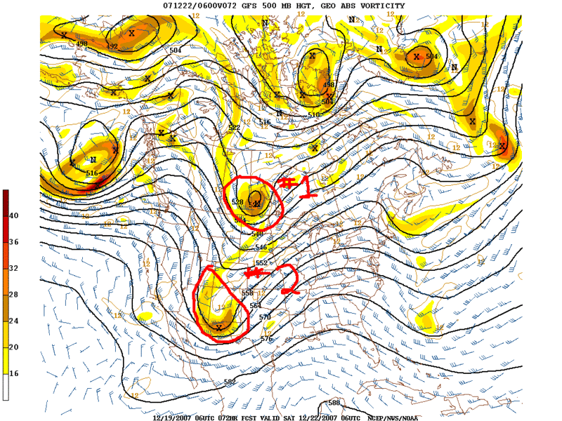
As you can see I have circled two pieces of vorticity (energy) that are working their way across the US. For the sake of ease I will call these storm #1 and storm #2. Strom #1 is up in Canada and is predicted to close off and become a full fledged strom while #2 has not closed off and is just beginning to try and wrap up. At this point #2 is called a trough. Now, if #2 were to closed off and look like #1 in the above picture then we would see a substantial snow storm here.
However, look below....
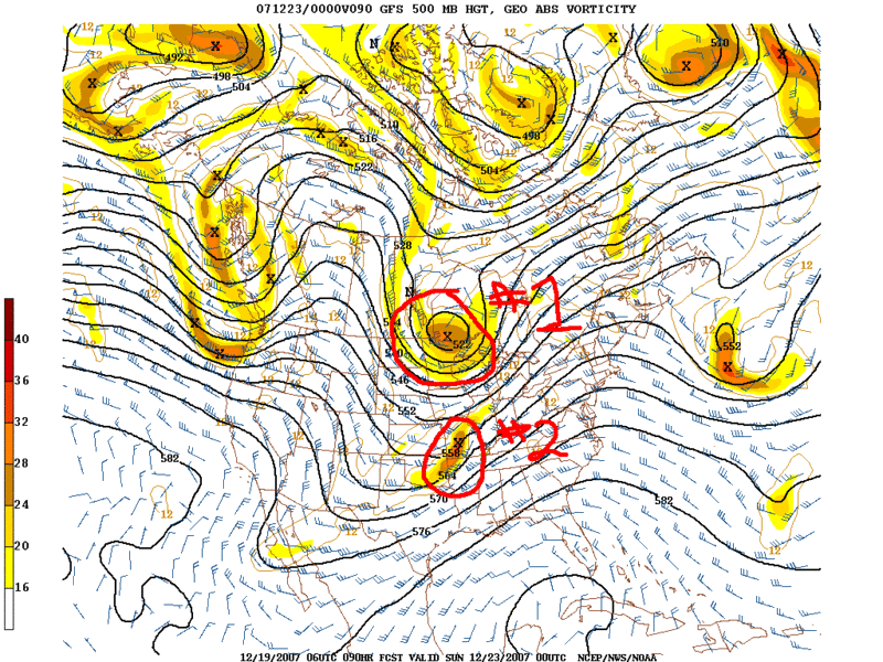
...it does not close off. In fact storm #1 actually sucks in most of the energy that #2 had originally. This is called phasing. #1 actually "ate up" #2. Now if this happens all we will see is a cold front and maybe a passing flurry or two.
If you are a snow lover you are hoping that #2 does not phase with #1. You hope it closes off and becomes its own storm. Could that happen? Yes! Will it happen? Probably not. Our best chance of snow would come from the chance that #2 phases with #1 AFTER it passes us by, not before. We will see if this happens. I predict that it won't and all we see is cold air and clouds from this system.
Later
posted by Mike P at
8:38 AM
![]()

0 Comments:
Post a Comment
Subscribe to Post Comments [Atom]
<< Home